|
AVADEPTH |
|
|
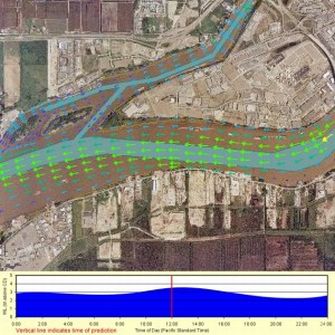
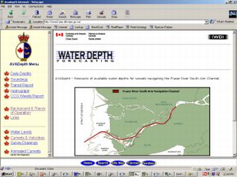
Fraser River Interactive Data Server The Fraser River in British Columbia, Canada is a waterway that is used for commercial shipping, fisheries and many other industries. Draining about one third of British Columbia, this environmentally sensitive river is subject to a 5 m tidal range, and flow rates up to 12,000 m3/s or higher during the freshet. Baird was contracted by the Canadian Coast Guard to setup a numerical model of the river in order to address water levels and current speeds in the river for navigation purposes. The selected modeling approach uses the one-dimensional model MIKE11, and the two-dimensional finite element model TELEMAC 2D. The one dimensional model provides water level and discharge data, and also defines the boundaries for the two dimensional model, which is used for determining current patterns. These two models cover the tidal reaches of the Fraser River system, which includes about 250 km of river channels. The results of these models were used to create a web site to provide mariners with navigation information along the river on a weekly forecast basis. View a sample of animated currents and water depth. Link to Fisheries and Oceans Canada - Coast Guard site and select the "Currents & Velocity" from the main menu. For more information on the Fraser River model, please contact Derek Williamson |
|